
Project overview
Site Location
The Kariba Hydro-electric Scheme is located approximately halfway down the Zambezi River that flows from the north-western part of Zambia, Southern Africa, to the Indian Ocean. It lies in the Gwembe Valley at Latitude 16031′ South and Longitude 28046′ East. The width of the Gwembe rift valley is 70km on average and is bordered on either side by escarpments which go approximately 700 metres high.
Background
The Electricity Supply Commission, instigated an investigation for possible hydro-electric schemes to be constructed at Kariba. In 1941, funds were made available and in 1955 the then Federal Government of Rhodesia and Nyasaland (Zambia, Zimbabwe and Malawi) called for tenders for the construction of the dam wall. The contract for the construction of the wall and power station was awarded to the Italian consortium Impresit on 16 July 1956.
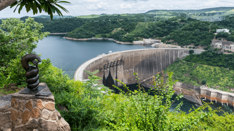
Kariba Dam was designed by the French engineer Andre Coyne. A specialist in “arch dams”, he personally designed over 55 dams, Kariba being one of them. Excavations of the foundations, construction of dam wall and power stations and the subsequent commissioning of the first generator took place between 1956 and 1960.
| Technical Data | |
|---|---|
| Type | Double Curvature Concrete Arch |
| Height | 128 metres |
| Crest Length | 617 metres |
| Crest Thickness | 13 metres |
| Base Thickness | 24 metres |
| Volume of Concrete | 1,036 million cubic metres |
| Spillway | |
|---|---|
| 6 No. Sluice gates | 9.14 x 8.84 metres |
| Discharge Capacity | 6 x 1574 cubic metres per second (at full supply level) |
| Plunge Pool | |
|---|---|
| Depth | 81 metres |
| Volume | 335 x 103 cubic metres of water |
| Reservoir (at full supply level) | |
|---|---|
| Length | 280 kilometres |
| Width | 32 kilometres (km) widest, (average 18 km) |
| Maximum Retention Level (MRL) | 487.8 metres (above mean sea level) |
| Minimum Operating Level (MOL) | 474.8 metres (above mean sea level) |
| Capacity at MRL | 185 x 109 cubic metres |
| Mean Annual Evaporation | 1.56 metres |
| Power Stations (Generating Capacity) | |
|---|---|
| North Bank | 1080 MW |
| South Bank | 1050 MW |
Dam Safety Performance Monitoring and Maintenance
Monitoring
Dam safety Monitoring consists of measurements of parameters which define the state of the structure and provide timely information on the behaviour of the dam complex. Visual surveillancesare conducted at regular intervals to look for symptoms that might warn of a developing failure.
An array of instruments are installed at strategic locations of the dam to monitor movements, stresses, deformations and discharges.
Geodetic Surveys are carried out periodically and these comprise Traverse, Triangulation and Levelling.
Maintenance/Inspection
Routine inspections provide information for routine maintenance work which is carried out periodically on the dam and its appurtenances. Works to stabilise the South Bank have been carried out and they include drilling of drainage adits, surface sealing of the South Bank slope and ground reprofiling.
Flood Gates
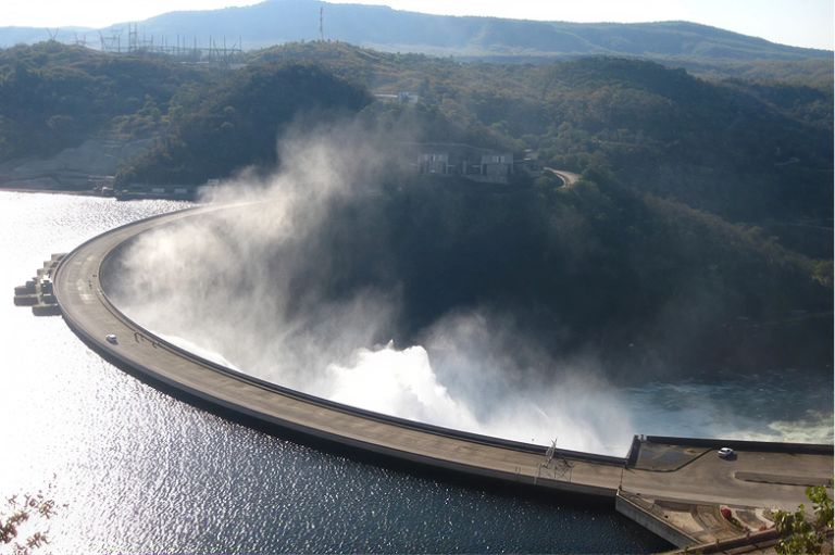
The spillway comprises six sluices each equipped with a caterpillar gate furnished with an electric programmable logical control hoist mechanism that provides safety in the operation of each gate.
Stilling Pool
The stilling pool is located below the spillway and serves to dissipate energy from the spillway discharge.
The Emergency Preparedness Program was compiled to aid the Dam Safety Monitoring Team during emergency situations or unusual occurrences. The program essentially outlines the following:
- Immediate actions to be taken
- Whom to notify
- What decisions to make
- Actions to take in an event of loss of communications
Emergency Situation:
An emergency situation is defined as a sudden and unexpectedcondition that may develop so as to endanger the structural integrity of the dam, or endanger downstream property and people.The situation would call for immediate action and attention.
Unusual Occurrence:
An unusual occurrence is defined as an event that takes place or a condition that develops that is not normally encountered in the routine operation of the dam and reservoir and which may endanger the dam.